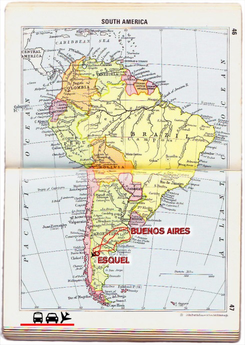
location Argentina – northwes of Chubut, inmediately south of the town Cushamen; located at 42 º 37 ‘42.53 “south latitude, 70 º 05’ 15.46” west longitude
circuit the canyon “La Buitrera” is a circuit of 3 km to 5 km.
elevation 505 meters to 680 meters
available all year ( road conditions better in the summer)
Personal experience leads me to speak of Piedra Parada first, because this is a place where a person can be at peace with themselves for a long time, is the place where the wind takes the best of you with meditation and new things will be born. Above all this place is lacking in the modern society, the space between people,invation of privacy, so it may seem a contradiction: listen to the silence.
In the midle of the Patagonic plato is located the beautiful area of “Piedra Parada” in the northwest of Chubut, at the Cushamen and Languiñeo departments.
From the city of Esquel, we travel about 140 km along the paved National Route No. 40, and then Provincial Highway No. 12, unpaved until Piedra Parada, passing by the town of Gualjaina.
From the coast, Puerto Madryn and Trelew, approximately 550 km along Provincial Route No. 25 near the town of Paso de Indios which joins Provincial Road No. 12 to 25, access to the area after passing through the tiny town Paso Berwyn, Cerro Condor and the town of Paso del Sapo.
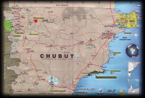 Provincial Highway No. 12 in its east-west section coincides with the course of the Chubut River middle, between the towns of Gualjaina west and east Paso del Sapo, and in that stretch through the southern edge of the remains of the volcano.
This area is a provincial protected area, where you can find local flora and fauna, and archaeological and paleontological remains of past eras. Inside the circuite of the canyon you can find an area of remains and if you like rock climming you can practice in the wall that is 50 meters high. You can also camp by the river, in front of the big rock.
This beautiful place is caracterized by the big rock, which has the name ” Piedra Parada”, it means “Standing Stone”. The rocks in the area can determine the age of the zone, which is the Jurrasic Period, but the standing stone was created in the Late Cretaceous, or Triassic period when the volcanic crater explodes out through a crack with form ring expulse much volcanic ash and gas, the crack was blocked, and this block formed “Piedra Parada”.
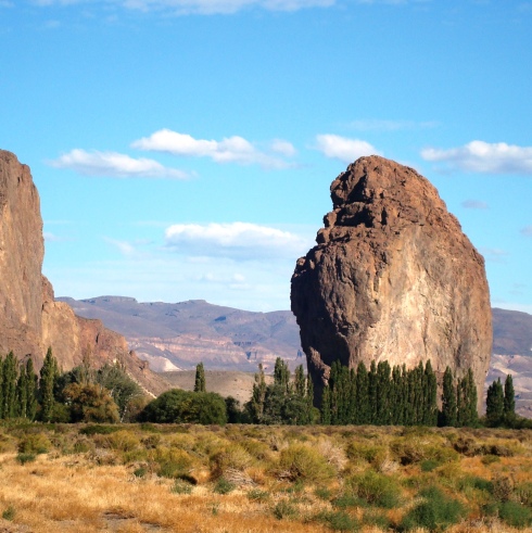
Clicking the image you can find a photo gallery.
For know more about the geology of this place: Piedra Parada -PDF linf in spanish with new geological information, and the new trails, also you can ask information on the turist point; and if you are interest of climbing rock, you have to comunicate with the “Club Andino Esquel” .
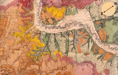
Here an extra image, it is an old map of the zone of “Piedra Parada”. This geological map was made in the begining of the XX century.
Tags: adventures, argentina, chubut, patagonia, piedra parada, stories, travel, world


